


Activity
Renewables
Vanguard West Offshore Wind Farm - Installation of Boundary Demarcation Buoyage
15 October 2026 17:02:39
Mariners are advised that on or about 1st November 2026 until further notice, the Multi Purpose Vessels “FCS Vega” and “TSM Bergen” shall be installing the boundary demarcation buoyage at the Vanguard West Offshore Wind Farm. on or about 16th October 2026 until further notice, the Guard Vessel (GV) “Jason 2” shall be supporting the infield monitoring of the Vanguard West Offshore Wind Farm, including the upcoming demarcation buoyage boundary installation.

Activity
Renewables
Inch Cape Export Cable 2 Joint Burial & Nearshore Cable Mattress Installation
15 October 2026 15:36:09
All mariners and stakeholders are advised that export cable 2 joint burial and nearshore cable mattress installation activities will commence.

Activity
Renewables
Galloper Offshore Wind Farm
15 October 2026 14:54:08
Galloper Offshore Wind Farm has completed the WTG Main Bearing Replacement Campaign Galloper Windfarm, RWE - NTM: GWF-O&M 08-2026 and that the Jack-up Vessel WIND ENERGY has left the field.

Activity
Renewables
East Anglia THREE Offshore Converter Station - OFCS Jack up Barge demobilisation- JB120
15 October 2026 14:29:24
Mariners are advised that circa between 07/10/2025 and 13/10/2025, the Jack-up Barge (JUB) ‘JB 120’ will commence jacking down next to the East Anglia THREE Offshore Converter Station (OFCS) within the East Anglia THREE Windfarm and departing from the area set out in section 2 of this document

Activity
Renewables
East Anglia 3 Offshore Substation - Jack Up Barge JB 120
15 October 2026 14:23:41
Mariners are advised that circa between 02/12/2025 and 06/12/2025, the Jack-up Barge (JUB) ‘JB 120’ will commence jacking up next to the East Anglia THREE Offshore Converter Station (OFCS) within the East Anglia THREE Windfarm array.

Activity
Renewables
Floating LiDAR Validation at NOAH met mast
15 October 2026 12:07:39
Venterra has deployed one Floating LiDAR Buoy in the area around the NOAH Met Mast under Marine Licence L/2020/00313/1. This document is to notify mariners regarding the deployment.

Activity
Subsea cables
Western HVDC Link: Geophysical Survey Operations, October-November 2026
15 October 2026 12:02:30
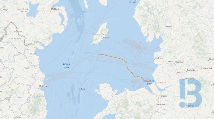
Survey work is due to be carried out along part of the Western HVDC Link cable route by the XOCEAN Uncrewed Survey Vessel (USV), X-16 Uncrewed. The work is due to start in October 2026.
Activity
Subsea cables
Eday HVAC Subsea Cable Marine Cable Route Survey Operations
15 October 2026 11:56:51
Mariners are advised that a marine cable route survey is planned for the proposed Eday HVAC Subsea Cable.

Activity
Oil and gas
NEP Nearshore Diver-Led Cable Installation Preparation Works
15 October 2026 11:55:20
Mariners are advised that the Northern Endurance Partnership will undertake nearshore marine works associated with the HDD2 offshore punchout and installation of a High-Density Polyethylene cable duct. The works will support the future installation of the NEP direct-current fibre-optic cable. The vessel Harris is now including within the scope

Activity
Oil and gas
Seafox 7 Transit from Douglas CCS Platform to Hamilton North
15 October 2026 11:51:50
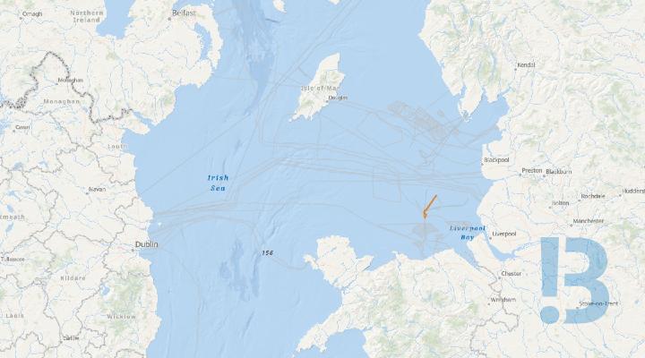
Mariners are advised that the Jack Up Support vessel Seafox 7 has completed work at Liverpool Bay CCS Douglas Platform. The vessel is scheduled to transit to stand – by at ENI UK Hamilton North Platform with the support of the tugs Multratug 35, Montrose and Svitzer Elizabeth on Saturday 17th October 2026 (weather dependant)
Activity
Subsea cables
Q&E South Cable Installation - France
14 October 2026 17:04:53
Global Marine Systems Limited (GMSL) has been contracted to supply and install the subsea system. Operations took place in Q2-Q3 2025 and Q2 2026 to complete the works up to the Final Splice position. Cable installation is currently underway with cable burial scheduled for week commencing Monday 19th October 2026.

Activity
Subsea cables
Skye-Uist - Survey and Subsea Cable Installation
14 October 2026 16:59:53
Please be advised that Jan De Nul Luxembourg S.A. has undertaken power cable installation and power cable protection activities for the Skye-Uist Replacement project from the 5th June 2026. Cable recovery and subsequent pull-in activities at Ardmore Bay will be undertaken.

Activity
Renewables
Rhyl Flats Windfarm - Maintenance Operations
14 October 2026 16:17:00
All mariners are advised that MPI Adventure will be carrying out maintenance operations at Rhyl flats Offshore Wind Farm from 18/10/2026 until 28/10/2026. At Locations RF13 , RF,17 and RF25.

Activity
Oil and gas
Stella - Anode skid installation
14 October 2026 14:45:36
Installation of anode skid and mattress/grout bags at the Stella Gas Export Structure at the CATS tee, within the Banff tee 500mz

Activity
Oil and gas
Greater Stella Area - Decommissioning Activities
14 October 2026 14:44:15
GSA flushing, disconnects and mid-water arch (MWA) removals

Activity
Oil and gas
Decommissioning - Alba Floating Storage Unit (FSU)
14 October 2026 14:41:59
The Alba Floating Storage Unit (FSU) has undergone flushing, cleaning and disconnection activities in preparation for removal from the Alba Field. The vessel is scheduled to be towed from the field on 20–21 July 2026. Existing field infrastructure, including the Mid-Water Arch (MWA), will remain in situ following the FSU departure until Sept/Oct. The Alba Northern Platform is remain on location and will continue to be supported by an ERRV.

Activity
Oil and gas
Alba - Southern Area Development Injection Equipment Disconnect
14 October 2026 14:40:23
As part of the Alba field decommissioning vessels will be in field to flush and disconnect the Alba xtreme south (AXS) and the Southern Area Development Injection Equipment (SADIE).

Activity
Oil and gas
Alba AXS Flush and Disconnect
14 October 2026 14:35:52
As part of the Alba field decommissioning vessels will be in field to flush and disconnect the Alba xtreme south (AXS) and the Southern Area Development Injection Equipment (SADIE).

Activity
Non specific
Bran Sands - Biological Survey
14 October 2026 14:28:12
Mariners are advised that Northumbrian Water Ltd will be undertaking marine biological survey within the Bran Sands Wider Survey Area, these surveys are in support of the Bran Sands Long Sea Outfall (LSO) Project. The survey will now begin on the 14th October.

Hazard
Subsea cables
Eastern Green Link 1 - Sediment Accumulation
14 October 2026 14:08:33
Sediment berms of up to 2 m remain within the pre-trenched area at the EGL1 Torness landfall. The sediment accumulation will remain in place until cable installation activities commence in 2027.
